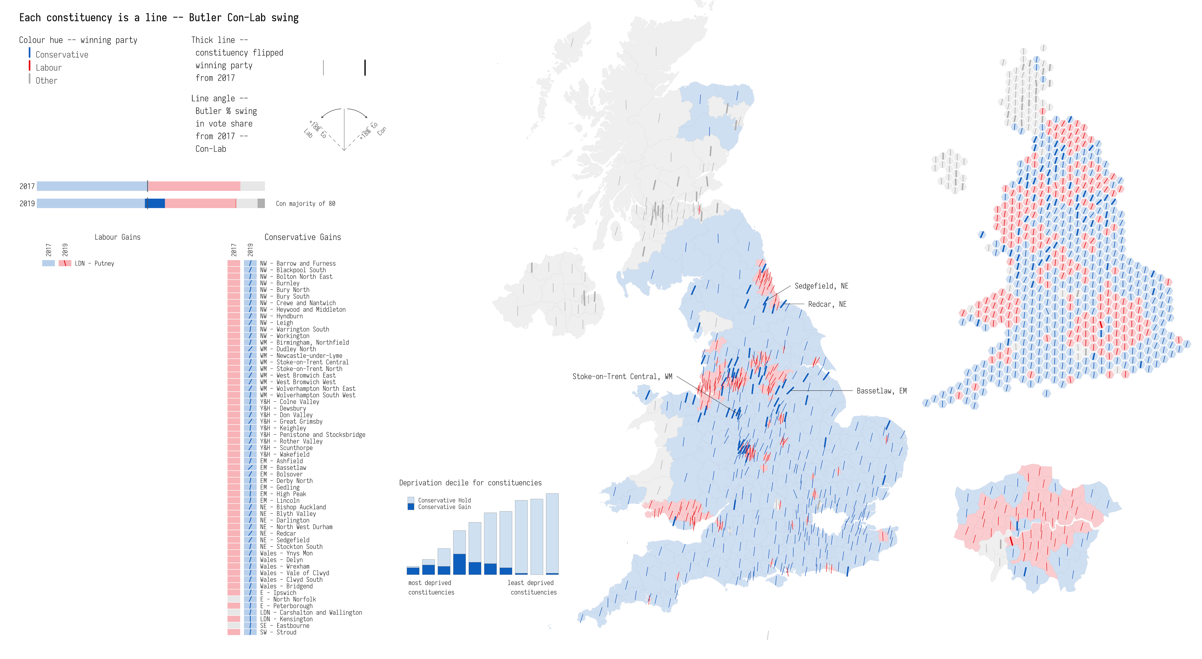
Using position, angle and thickness to expose the shifting geographies of the 2019 UK General Election

populism
political geography
cartograms

Roger Beecham (2020) “Using position, angle and thickness to expose the shifting geographies of the 2019 UK General Election” Environment and Planning A: Economy and Space, doi: 10.1177/0308518X2090939

Author
Affiliation

School of Geography, University of Leeds

Published

March 2020

Doi

Important figure

Figure 1: Map of the Butler two-party Conservative–Labour shift in the 2019 UK general election. 2019 data collated by Alex Denvir, 2017 data from the Electoral Commission, boundary data from the Office of National Statistics Open Geography Portal and hex cartogram from ESRI’s Ben Flanagan.

BibTeX citation

@article{beecham_using_2020,
     author = {Beecham, R.},
     title = {{Using position, angle and thickness to expose the shifting geographies of the 2019 UK General Election}},
     journal = {{Environment and Planning A: Economy and Space}},
     pages = {833--836},
     volume = {52},
     number = {5},
     year = {2020}
}